

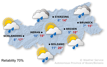
Overall situation A high-pressure system will persist over the Alps, but with temporarily more unstable air masses.
Forecast It will be sunny with some larger cumulus clouds in the afternoon, leading to some thunderstorms that may continue into the night.
Temperatures Summer temperatures, with highs ranging from 26° to 32°.
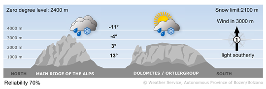
Situation A high-pressure system will persist over the Alps, but with temporarily more unstable air masses.
Mountainforecast A few thunderstorms may pass through from the west during the afternoon and evening.
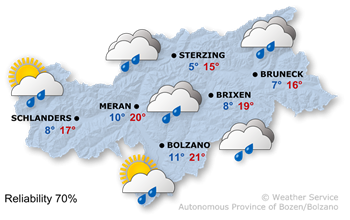
Overall situation High air pressure and fairly stable air masses will determine the weather in South Tyrol.
Forecast Sunny weather, morning low stratus clouds will clear quickly,. Cumulus clouds will form in the afternoon, though the likelihood of thunderstorms will generally remain low.
Temperatures Temperatures will reach highs of 25° to 31°.
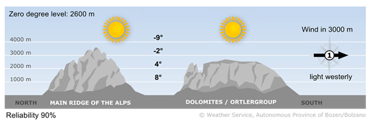
Situation High air pressure and fairly stable air masses will determine the weather in South Tyrol.
Mountainforecast The sun will shine across most of the mountains. The cumulus clouds in the afternoon will mostly remain harmless, with isolated thunderstorms most likely in the Dolomites.

max 23° / 31°

max 24° / 32°

max 25° / 33°
